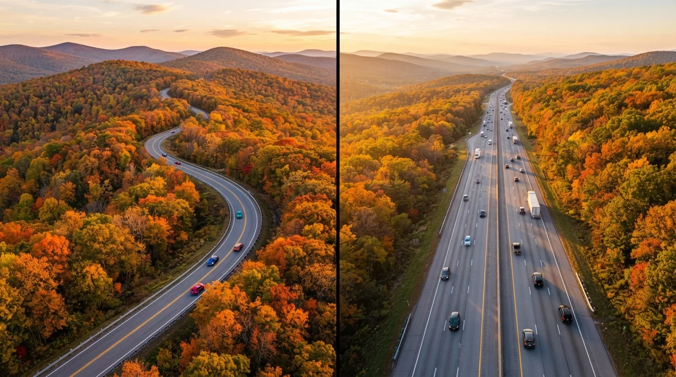
What Separates a Byway from an Interstate?
The term scenic byway refers broadly to a designated road recognized for its natural, cultural, historic, or recreational qualities. The Federal Highway Administration's National Scenic Byways Program has recognized more than 150 such routes - from the Natchez Trace Parkway in Mississippi to the Going-to-the-Sun Road in Montana. Many states maintain their own additional byway designations beyond the federal list.
Interstates, by contrast, are the backbone of the US highway system - engineered for high-speed, high-volume travel with controlled access, consistent lane widths, and standardized signage. They're reliable by design, not beautiful by accident.
The practical gap between them is real: a byway might cover 50 miles in two hours due to curves, speed limits, and irresistible pull-offs, while 50 interstate miles can vanish in under an hour. That time difference is either a feature or a flaw, depending entirely on what kind of trip you're taking. For inspiration on America's most iconic routes, see America's great road trip routes.
The Case for Scenic Byways
Byways earn their reputation by delivering what interstates simply cannot: genuine engagement with the landscape. Driving a byway through the Ozarks, the Columbia River Gorge, or along Virginia's Skyline Drive puts you inside the scenery rather than beside it at 75 mph.
Beyond aesthetics, byways often thread through small towns and historic communities that expressways bypass entirely. These stops - roadside diners, local museums, state parks - are frequently the moments travelers remember most vividly. If your trip philosophy leans toward discovery over destination, byways align naturally with that approach. The travel itinerary vs. open-ended travel question is worth considering before you commit to a byway-heavy route.
Mix and Match for the Best of Both
Before finalizing your route, pull up your state DOT map and identify one or two byway segments near your interstate corridor. Even a 30-mile detour through a designated scenic area can transform an otherwise routine driving day. Download offline maps in advance for byway stretches where cell service is unreliable.
For travelers curious about roads that rarely appear on popular itineraries, hidden gem drives across the US offers a solid starting point for lesser-known byway adventures.
The Case for Interstates
Interstates exist to move people efficiently, and they do exactly that. For trips where arrival time matters - family visits, event deadlines, or simply covering 600 miles in a single day - the interstate is the rational choice. Rest areas appear at predictable intervals, gas stations cluster at nearly every exit, and emergency services can reach you quickly if something goes wrong.
Interstates also tend to be gentler on vehicles. Consistent pavement quality and absence of sharp curves reduce wear compared to some rural byways, particularly gravel or narrow mountain roads. If you're towing a trailer, driving an older vehicle, or traveling in winter, the interstate's engineering advantages become safety advantages.
| Scenic Byways | Interstates | |
|---|---|---|
| Travel speed | Slower; frequent curves and speed limits | Fast; designed for sustained highway speeds |
| Scenery and experience | High; landscapes, towns, and cultural stops | Low to moderate; functional, repetitive |
| Services (fuel, food, lodging) | Sparse; plan stops carefully | Abundant; exits every few miles in most regions |
| Cell coverage | Often limited in rural or mountain areas | Generally reliable along most corridors |
| Vehicle suitability | May challenge older or low-clearance vehicles | Suitable for virtually all road vehicles |
| Best season flexibility | Seasonal closures common; verify before travel | Open year-round in most conditions |
Those planning a drive that compares regional route types might also find value in coastal drives vs. interior highways, which examines similar trade-offs at a regional scale.
Building a Smarter Route: Using Both
The most satisfying road trips rarely commit exclusively to one road type. A practical framework: use interstates to absorb the necessary mileage between regions, then peel off onto byways when you're in areas worth savoring slowly. Tools like the FHWA's America's Byways website and state DOT maps let you identify byway segments near your planned corridor before you leave home.
Consider time buffers honestly. A byway that adds 45 minutes to your drive is manageable; one that adds three hours might derail an entire day's plan unless you've built that flexibility in advance. Road tripping solo vs. with a group also affects this calculus - solo travelers can pivot spontaneously, while group logistics often demand firmer timing.
Always verify byway conditions before departure, especially in mountain or desert regions where seasonal closures, road quality, and cell coverage gaps are real factors. Check with state DOTs or the National Park Service for current access information. Safe driving on any route starts with preparation - the road safety guidance hub covers habits and hazards worth reviewing before any long drive.